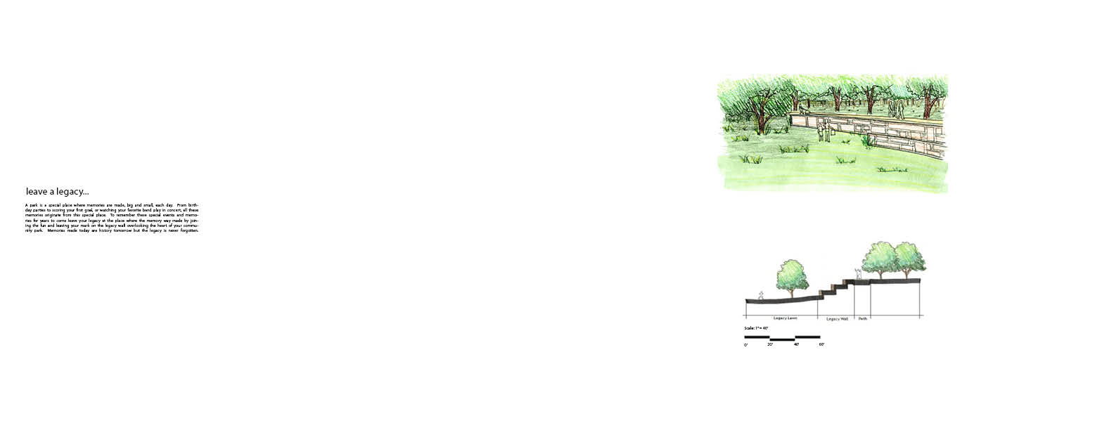
For this project we were asked to develop portfolio spreads in Adobe InDesign displaying a project of our choice from our past design studios. I decided to use my final project (Legacy Park) from my Parks and Open Space design studio. I created a series of spreads that walk through a short design process along with what is being proposed on the site. Here are my final spreads!
Wes Rogers LA 280
Tuesday, April 30, 2013
Monday, April 15, 2013
Unit 06: Precision Drafting with AutoCAD
For unit 06 our class was asked to explore the many uses and techniques AutoCAD has to offer when completing construction style documents that can be used to take our creative ideas and demonstrate how they can be feasible. We started off with a basic household setting to grasp a basic understanding of AutoCAD's power. We worked with site plans, dimensions, sections, and detailed plans and sections to describe what was happening on our site. Through this exercise we learned many techniques in AutoCAD such as line weights, layer management, complex commands, and hatching to name a few. Here is the finished product!
Tuesday, April 9, 2013
AutoCAD Plan + Section
Here are some preliminary plans and sections created for one of our checkpoints in class this week. Improvements to come!
Tuesday, March 26, 2013
SketchUP
For unit 7 we were asked to use our AutoCAD documents we previously created to be used as an aid in develop a 3D model of our site through the use of SketchUP. Here are some of the images taken directly from the model.
This image is an aerial view of my site:
This image is an aerial view of my site:
This image is a perspective view showing the backyard area:
This image is a plan view of the entire site:
This image is a section cut through my site. This section cut also shows the formation of my vegetated swale. This green infrastructure is created by the formation of topography sloping upwards around the driveway and home. This formation of topography creates a small depression where water can be more properly managed in the swale instead of running off the site at a fast rate.
Tuesday, March 19, 2013
AutoCAD :)
Here is my final AutoCAD project for Unit 6. For this project we were asked to practice our AutoCAD skills learned throughout the past week. This project situated several elements of a residential landscape together. I used various layers to draw the various elements of the residential space. Also the use of line weights creates depth and a make the drawing more user friendly to understand.
Monday, March 11, 2013
Unit 5b Final
Here are the final three presentation boards for Unit 5b. Board number one describes the analysis completed at the Muncie Fairgrounds. Topics such as storm water run-off, circulation, open space, and views into the sight were completed. Board number two shows before and after section/perspectives along key areas around the fairgrounds. Finally board number 3 displays a day and night perspective of what the site could look like.
Wednesday, February 20, 2013
Illustrator Diagrams Final
Here are my final diagrams for Unit 5. For this project I used GIS and AI computer programs to create analysis diagrams for the Muncie Fairgrounds. Topics that I presented include Storm Water, Circulation Patterns, Open Spaces, Buildings, Trees, and Wind Patterns. Showing one layer of information has the benefit of displaying specified pieces of information stacked together to create a cohesive analysis of the selected site.
Subscribe to:
Posts (Atom)


.jpg)
.jpg)
.jpg)
.jpg)
.jpg)
.jpg)
.jpg)
.jpg)
.jpg)